Tuesday, September 10, 2024
Pre-Conference
NSDI Marcom Workshop

Moderator
Christopher H Barlow
Director
Corporate Engagement & Career Management
University of Pittsburgh, Joseph M. Katz Graduate School of Business

Alan Leidner
Board Member
NYC/GISMO
Alan Leidner completed a Masters Degree in Urban Planning from Brooklyn's Pratt Institute in 1975. He served as Assistant Commissioner in the NYC Department of Information Technology and Telecommunications (DOITT) from 1998 to 2004, in charge of the City's GIS Utility. In the Fall of 2001, he organized and managed the Emergency Mapping and Data Center (EMDC) which provided information and mapping services to 9/11 responders. Alan has also worked for Booz, Allen, Hamilton on critical infrastructure protection, and for the Fund for the City of New York heading their Center for Geospatial Innovation. He currently serves on the Board of Directors of the NYC Geospatial Information Systems and Mapping Organization (www.gismonyc.org) and has worked with the Open Geospatial Consortium on the MUDDI underground infrastructure data model, a COVID related health data model, an Emergency Location and Language Application, and a study of Extreme Heat Events. Additionally, he serves as an advisor to Utility Mapping Services (USMI), and to New York University on their UNUM - NYC infrastructure mapping project. Mr. Leidner was a recipient of the 2001 NYC Sloan Public Service Award and the 2002 ESRI Presidential Award. Among other writings, Alan's "Geo-Info CONOPS" article was published by GeoWorld Magazine in October, 2007. In 2022 a Smart Cities chapter he co-authored with OGC's George Percivall, was published in the Springer Handbook of Geographic Information, 2nd Edition.

Joshua Delmonico
Executive Director
US Federal Geographic Data Committee
Mr. Joshua Delmonico serves as the Executive Director for the Federal Geographic Data Committee providing the leadership, coordination, and communication to promote the development, use, sharing, and dissemination of geospatial data nationwide. In this role he provides executive leadership for the coordination of U.S. federal geospatial activities in collaboration with the 32 FGDC member Federal Agencies and OMB to implement the Geospatial Data Act and conduct strategic planning and visioning for the implementation of the National Spatial Data Infrastructure (NSDI). Previously, Mr. Delmonico led several Geospatial programs for the Department of Defense where his portfolio included architecture, engineering, standards, testing, enterprise system development, modeling and simulation, 3D, AR/VR, and artificial intelligence. He has a B.S. in Biology from the State University of New York at New Paltz (1994) and a M.S. in National Resource Strategy from the Industrial College of the Armed Forces (2010). He lives in Alexandria with his wife and two boys.

Ken Shaffer
Deputy Executive Director
US Federal Geographic Data Committee
Ken Shaffer is the Deputy Executive Director for the Federal Geographic Data Committee, administered by the U.S. Geological Survey. His work includes the strategic planning and development for the National Spatial Data Infrastructure, Federal geospatial policy, interagency geospatial initiatives, and non-Federal constituent collaboration. Ken's career has been divided between the private, State, and Federal (civil and military) sectors, and has consistently included roles in interagency and multi-tiered geospatial program coordination. A geographer by degree, Ken has 37 years of experience in the geospatial profession.

Kim Hansen
Geospatial Marketing Director
Woolpert
Becci Anderson
Chief of User Engagement
National Geospatial Program, USGS
Becci Anderson is the Chief of User Engagement with the USGS National Geospatial Program, leading a team of liaisons from across the country who cultivate collaborations, provide outreach and education, and foster partnerships for The National Map. She holds a Master of Science degree in geography from Oregon State University, and serves on the Board of Advisors for the Oregon State University College of Earth, Ocean, and Atmospheric Sciences. Beccihas extensive experience in national and international project coordination, outreach and communications, strategic planning, and program management and governance, with expertise in GIS, cartography, and spatial data analysis. Throughout her career, Becci has had roles in numerous publications, initiatives, and programs such as the Alaska Mapping Executive Committee, USGS 3D Hydrography Program, FGDC NGDA Themes, Arctic Council CAFF Biodiversity Monitoring Programme, Arctic Spatial Data Infrastructure, Interagency Arctic Research Policy Committee (U.S. Arctic Research Plan: FY2017-2021), U.S. Air Force GeoBase Program, and The Atlas of International Freshwater Agreements.

Sheila Steffenson
CEO
1Spatial Inc.
Sheila Steffenson is a highly experienced GIS and Data Management specialist with over 35 years of experience in the GIS industry (both in the public and private sectors). The majority of her career (23 Years) was spent with Esri, starting as a technical resource, then moving quickly to an account management role. After 3 years she was named Manager for the South-Central US Region and grew the organization from 5 to 50 staff before moving to DC to establish and grow the Federal Sciences Team. She joined 1Spatial over 8 years ago, taking on the role of CEO to build out the knowledge and use of the 1Spatial Data Management solutions across the Americas. In this role, she has grown the organization on "this side of the pond" significantly while also overseeing the organization's operations and overall success, from client satisfaction to P&L. She is a strong promoter of the need for a true NSDI based upon technology innovations and collaborative efforts that can make a major impact upon its success.
Roundtable on interdisciplinary inter-organization research and innovation in geospatial

Moderator
Dr. Nadine Alameh
Executive Director
Taylor Geospatial Institute
Dr. Nadine Alameh is the Executive?Director of the Taylor Geospatial Institute (TGI) - founded in St. Louis to fuel geospatial science & technology for global impact. Nadine is a recognized geospatial leader with experience in Disaster Preparedness, Climate Impact, Earth Observations, and Defense. Prior to TGI, she was CEO of the Open Geospatial Consortium (OGC), senior advisor to NASA, entrepreneur and startup founder, and Chief Innovation Architect at Northrop Grumman. Nadine sits on the board of the Private Sector Network of the UN Committee of Experts on Global Geospatial Information Management (UN-GGIM); and is an appointed member of the US National Geospatial Advisory Committee (NGAC). She's the recipient of the prestigious 2023 Women in Technology Leadership award, the 2022 Geospatial World Forum Diversity Champion award, and the 2019 Canada Geomatics Leadership award. Nadine holds a Ph.D. and 2 M.S. degrees from MIT.

Dr. Debra Laefer
Professor, Director Center for Urban Science
and Progress NYU Tandon School of Engineering

Dr. Rachel Opitz
Program Manager, Geospatial Innovation for Food Security
Taylor Geospatial Institute

Matt Forrest
Field CTO
CARTO

Dr. Kathleen Stewart
Professor, Department of Geographical Sciences, Director-Center for Geospatial Informational Science
University of Maryland
Deirdre Dalpiaz Bishop
Chief Geography Division
U.S. Census Bureau

Dr. Leslie Jones
GIO
State of Alaska

Sarah Hodgetts
Director
UK Geospatial Commission DSIT

Dr. Shaowen Wang
Professor and Associate Dean
Urbana-Champaign, University of Illinois

Talbot Brooks
Director
The Geospatial Center, Delta State University
Professor Talbot Brooks is the Director of the Geospatial Center at Delta State University and program chair for the Bachelor of Applied Science in Geospatial Analysis and Intelligence, a US Geospatial Intelligence Foundation accredited degree program. A 38-year veteran of the fire service, he is Director of the North America Office of the United Nations Platform for Space-Based Disaster and Emergency Response (UN-SPIDER), adjunct faculty at the U.S. National Fire Academy, and Chief Engineer for the Bolivar County Volunteer Fire Department. A retired Army officer, he is passionate about providing educational opportunities for current and former members of the armed services. His entrepreneurial interests include indoor positioning for emergency response (IndoorGeo.com), climate risk and agriculture (ag-management.com). Above all, he is committed to reducing the pain, suffering, and loss caused by crisis through GEOINT education and technologies and expects to complete his doctorate in Fire and Emergency Management at Oklahoma State University in 2025.
CDO/GIO Summit

Kim Valentine
GIO
NOAA

Dr. Leslie Jones
GIO
State of Alaska

Tim Johnson
GIO
State of North Carolina, NC Center for Geographic Information and Analysis

Megan R. Compton
GIO
State Of Indiana

Susan Miller
Geospatial Information Officer (GIO)
State of Georgia
Daniel Gall
Chief Strategy Officer
US Dept of Veterans Affairs

Amy Nelson
GIO
U.S. Department of Transportation
Amy Nelson is the Chief Geospatial Information Officer (GIO) at the U.S. Department of Transportation, where she has worked since 2006. She also serves as DOT's Senior Agency Official for Geospatial Information. She directs DOT's Geospatial Management Office, leads DOT's implementation of federal geospatial regulations and guidance including the Geospatial Data Act, and wrote and implemented US DOT's GIS Strategic Plan. She guides the successful delivery of DOT's enterprise GIS solutions and enables data-driven decision-making and storytelling with geospatial data and services. In her previous role as the Deputy GIO, she managed the GIS Task Force's response to events and disasters. Ms. Nelson has nineteen years of service in the federal government. She holds a B.A. in Geography from the University of Mary Washington and an M.A. in GIS from Clark University.
David Orso
Deputy Chief Data Officer
U.S. Veterans Administration

Dominique Duval-Diop
Deputy Chief Data Officer
U.S. Department of Commerce

Hanna Bonestroo
Ph.D Student
Tandon School of Engineering, New York University

Cordell Schachter
CIO
U.S. Department of Transportation
Cordell Schachter was sworn in as Chief Information Officer of the U.S. Department of Transportation on August 30, 2021. He serves as principal advisor to the Secretary of Transportation and to the leadership of DOT Operating Administrations on matters involving information technology (IT) and information assurance including cybersecurity and privacy. He leads DOT's Office of the Chief Information Officer (OCIO) and its collaborative teams and dedicated personnel responsible for the projects and services required to meet DOT's strategic goals and mission "to deliver the world's leading transportation system, serving the American people and economy through the safe, efficient, sustainable, and equitable movement of people and goods."
Cordell and OCIO oversee the Department's IT portfolio and its $3.5 billion in annual spending. They ensure all IT projects and investments are planned and implemented according to government best practices. They lead the department's efforts to transform DOT by creating smart technology solutions, promoting innovation, and strengthening DOT's cybersecurity, in accordance with the Federal Information Technology Acquisition Reform Act (FITARA), the Federal Information Security Management Act (FISMA), other laws, and executive orders in support of DOT's mission.
Previously, Cordell served as the New York City Department of Transportation's (NYC DOT) Chief Technology Officer and CIO for over 13 years and served in NYC government for a total of 26 years in a variety of roles. He led NYC DOT teams to innovate services and improve accessibility of New York City's physical infrastructure of roads, bridges, sidewalks, and transportation technologies, and to launch new mobility such as Bike Share and e-Scooter Share. The teams also improved the NYC's virtual infrastructure of digital services for inspections, permitting, mapping, data, communications, and economic development. They responded to crises by maintaining and transforming services during the rapid restoration after Superstorm Sandy and a by making a quick transition to telework and implementing Open Restaurants during the NYC's Covid-19 pandemic response.
Cordell also worked in leadership positions at several IT companies and was elected to NYC's largest community school board overseeing 50,000 K-8 students where he served as president and secretary. He created and taught the masters level course "Civic Technology for Innovation" at NYU and at Saint Peter's University in Jersey City, NJ. He's is a certified project manager and holds an MS in Management from NYU's Wagner School of Public Service, and a BA in Economics from SUNY Buffalo. He served on the board of directors of ITS America, served on Hunter College's Computer Science Advisory Board, and serves on SUNY Buffalo's College of Arts & Sciences Dean's Advisory Council.
Community Benefits: Modernized National Spatial Reference System
Moderator
Brad Kearse
Acting Director
National Geodetic Survey

Linda Foster
Director
Land Records, Esri

Galen Scott
Constituent Resources Manager
NGS

Dr. Michael Tischler
Director
National Geospatial Program (NGP)
U.S. Geological Survey (USGS)

Tim Burch
Executive Director
National Society of Professional Surveyors (NSPS)

Josh Novac
Senior Geospatial Technology Manager: Associate Vice President
Dewberry
Josh is a Program Manager for Dewberry's USGS GPSC contract as well as the head of Dewberry's Geospatial Technology Innovation team for Remote Sensing. With 17 years at Dewberry Josh has supported the development of programs for Topographic Lidar, Topobathymetric Lidar, Elevation Derived Hydrography, and feature extraction. His work on process improvement has helped reduce Lidar processing costs through his development of new automated tools and processes to efficiently extract additional information from Lidar data, including buildings and vegetation.

Dana J. Caccamise II
Pacific Southwest Regional Advisor
NOAA NGS
Networking Lunch
Workshop on ROI Assessment for National Geospatial Infrastructure
Piloting NSDI Governance and Coordination

Moderator
Cyril Smith
State GIO / MassGIS Director
MassGIS (Bureau of Geographic Information)

Derald Dudley
Chair Geospatial Transportation Subcommittee US Dept of Transportation

Joshua Delmonico
Executive Director
US Federal Geographic Data Committee
Mr. Joshua Delmonico serves as the Executive Director for the Federal Geographic Data Committee providing the leadership, coordination, and communication to promote the development, use, sharing, and dissemination of geospatial data nationwide. In this role he provides executive leadership for the coordination of U.S. federal geospatial activities in collaboration with the 32 FGDC member Federal Agencies and OMB to implement the Geospatial Data Act and conduct strategic planning and visioning for the implementation of the National Spatial Data Infrastructure (NSDI). Previously, Mr. Delmonico led several Geospatial programs for the Department of Defense where his portfolio included architecture, engineering, standards, testing, enterprise system development, modeling and simulation, 3D, AR/VR, and artificial intelligence. He has a B.S. in Biology from the State University of New York at New Paltz (1994) and a M.S. in National Resource Strategy from the Industrial College of the Armed Forces (2010). He lives in Alexandria with his wife and two boys.

Alan Leidner
Board Member
NYC/GISMO
Alan Leidner completed a Masters Degree in Urban Planning from Brooklyn's Pratt Institute in 1975. He served as Assistant Commissioner in the NYC Department of Information Technology and Telecommunications (DOITT) from 1998 to 2004, in charge of the City's GIS Utility. In the Fall of 2001, he organized and managed the Emergency Mapping and Data Center (EMDC) which provided information and mapping services to 9/11 responders. Alan has also worked for Booz, Allen, Hamilton on critical infrastructure protection, and for the Fund for the City of New York heading their Center for Geospatial Innovation. He currently serves on the Board of Directors of the NYC Geospatial Information Systems and Mapping Organization (www.gismonyc.org) and has worked with the Open Geospatial Consortium on the MUDDI underground infrastructure data model, a COVID related health data model, an Emergency Location and Language Application, and a study of Extreme Heat Events. Additionally, he serves as an advisor to Utility Mapping Services (USMI), and to New York University on their UNUM - NYC infrastructure mapping project. Mr. Leidner was a recipient of the 2001 NYC Sloan Public Service Award and the 2002 ESRI Presidential Award. Among other writings, Alan's "Geo-Info CONOPS" article was published by GeoWorld Magazine in October, 2007. In 2022 a Smart Cities chapter he co-authored with OGC's George Percivall, was published in the Springer Handbook of Geographic Information, 2nd Edition.
Dr. Amy Rose
Technical Director
Overture Maps Foundation

Ryan Bank
Global Managing Director
Geospatial Insurance Consortium [GIC]

Megan R. Compton
GIO
State Of Indiana

Teal Wyckoff
Associate Director, Geospatial Services
The Nature Conservancy
Teal Wyckoff is the Associate Director of Geospatial Services in the Conservation & Geospatial Systems Group at The Nature Conservancy, a 6,500+ person global conservation organization working in all 50 states in the U.S. and 79 countries worldwide. Teal's role includes strategic work in leveraging geospatial technology to support science-driven decisions for conservation and leading a team that directly enables geospatial practitioners and scientists to access and use geospatial technology, cloud-based computing, and data management solutions. Before transitioning to TNC, Teal worked in the state and academic GIS realms, including with the Wyoming Geographic Information Science Center at the University of Wyoming. Teal has 18 years of experience in the geospatial profession, with degrees in Geography, Environment and Nature Resource Management, and Ungulate Ecology.

Dr. Rachel Opitz
Program Manager, Geospatial Innovation for Food Security
Taylor Geospatial Institute
Welcome Reception
Wednesday, September 11, 2024
Plenary Sessions
Welcome and Opening Keynote Address
Jon Gustafson
Vice President, Americas
Geospatial World LLC
Jon Gustafson has over 20 years of experience in the geospatial and built environment sectors. As Vice President of Americas at Geospatial World, Jon leads efforts to grow and strengthen its position across the Americas. He is dedicated to making a positive impact on the economy and society by promoting geospatial knowledge, advocating for its broad use, and integrating geospatial and space technologies to support sustainability and innovation. His career includes leadership roles at ENR Top 50 companies and the US Army Corps of Engineers, where he spearheaded digital transformation initiatives, managed large multidisciplinary teams, and championed emerging technologies in the AEC industry. Jon is known for his ability to navigate complex market dynamics and develop strategies that align business objectives with sustainable growth. His leadership has fostered innovation, enhanced operational efficiency, and delivered successful, innovation-rich projects across sectors such as transportation, infrastructure, energy, and water resources. With a focus on practical, results-driven solutions, Jon is committed to advancing geospatial knowledge to address global challenges and contribute to the development of smarter, more resilient communities.

David Applegate
Director
US Geological Survey
Plenary Session 1: Moving Forward - US Geospatial Strategy from Plan to Practice

Moderator
Joshua Delmonico
Executive Director
US Federal Geographic Data Committee
Mr. Joshua Delmonico serves as the Executive Director for the Federal Geographic Data Committee providing the leadership, coordination, and communication to promote the development, use, sharing, and dissemination of geospatial data nationwide. In this role he provides executive leadership for the coordination of U.S. federal geospatial activities in collaboration with the 32 FGDC member Federal Agencies and OMB to implement the Geospatial Data Act and conduct strategic planning and visioning for the implementation of the National Spatial Data Infrastructure (NSDI). Previously, Mr. Delmonico led several Geospatial programs for the Department of Defense where his portfolio included architecture, engineering, standards, testing, enterprise system development, modeling and simulation, 3D, AR/VR, and artificial intelligence. He has a B.S. in Biology from the State University of New York at New Paltz (1994) and a M.S. in National Resource Strategy from the Industrial College of the Armed Forces (2010). He lives in Alexandria with his wife and two boys.

Patty Mims
Director
Global National
Government, Esri
Ms. Mims is currently the Director of Global National Government at Esri. In this role she oversees all Esri's work across the U.S. Federal Government, including Intelligence, Defense, Public Safety, & Federal Civilian; Non-Profit Programs globally, Education, Imagery/Remote Sensing; as well as International support to National Government organizations around the world. Ms. Mims also currently serves on the Board of Directors for the Open Geospatial Consortium (OGC), as well as the Chairperson for the Board of Advisors for the College of Natural Resources, Virginia Tech. She was formerly on the board of United State Geospatial Intelligence Foundation for four years. She has spent her twenty-five-year career in the GIS industry supporting the missions of defense, intel, homeland security, federal and international customers. Ms. Mims graduated with a bachelor's science degree in Geography and Certification in Secondary Education, Mary Washington University, and master's science degree in Geography/GIS from Virginia Tech.

Sarah Hodgetts
Director
UK Geospatial Commission DSIT

Deirdre Dalpiaz Bishop
Chief Geography Division
U.S. Census Bureau

Dr. Jeffrey D. Hamerlinck
President
University Consortium for Geographic Information
Science (UCGIS) Director, WyGISC

Eric Loubier
Director General
Natural Resources Canada (NRCan), Canada Centre for Mapping and Earth Observation

Christine Stinchcomb
Commercial/GIS Division Manager
Cobb County Board of Tax Assessors
Christine A. Stinchcomb, CMS, GCA is the Commercial/GIS Division Manager for Cobb County, GA Board of Tax Assessors. Dedicated professional with nearly 24 years of comprehensive experience in the assessment industry, specializing in cadastral mapping and GIS. Christine holds a Cadastral Mapping Specialist (CMS) designation with the International Association of Assessing Officers (IAAO) and Georgia Certified Appraiser (GCA) designation with Georgia Association of Assessing Officials (GAAO). She is an Instructor for IAAO and serves on several committees for both the GAAO (Education (Chair), GIS & Technology) and IAAO (COGO delegate, NSGIC delegate).
Keynote Address

Moderator
Mark Reichardt
Senior Consultant
Geospatial World LLC

Bobby Shackelton
Chief Operating Officer
riskthinking.ai

Jack Dangermond
President
ESRI
Networking Tea/Coffee
Plenary Session 2: Seeing is Believing - Communicating the Value of our Geospatial Ecosystem for National Development and Sustainability

Moderator
Megan R. Compton
GIO
State Of Indiana

Amy Barron
Power Grid Operations Manager
Duke Energy [GIS Carolinas]
Amy attended undergraduate and graduate school at the University of South Carolina. She worked in both public and private sectors before joining Duke Energy in 2008. While at Duke she has used GIS to site substations and transmission lines for the Transmission Engineering Organization and created a common platform GIS application for Real Estate. She was recently the Manager of GIS, Centralized Design, and Residential Development for Customer Delivery Carolinas. Amy co-founded a grassroots GIS Users Group called COMPASS and created and hosts Duke Energy's Annual GIS Day now in its fourteenth year. She is past chair of Energetic Women within Duke and currently sits on the national MEA Energetic Women Leadership Team. She was the first female President of the North Carolina ArcGIS Users Group and currently serves on the NC Geographic Information Coordinating Council, the NC Geodetic Survey Advisory Council, and the NC Underground Damage Prevention Review Board. Amy works out of the Duke Energy Headquarters in Charlotte, NC, and she earned her PLS in 2014 and GISP 2004.

Andy Neal
Senior Managing Director
Aon
Andy recently joined Aon as a Senior Managing Director to lead efforts focusing on physical climate and natural catastrophe analytics and risk transfer in both private and public sector contexts. Before joining Aon, Andy was Chief Actuary of FEMA's National Flood Insurance Program. He led the team that established the NFIP's reinsurance and catastrophe bond program and led the development of "Risk Rating 2.0", a transformation of the NFIP's rating to incorporate the latest in catastrophe models and actuarial science. He participated in various legislative and administrative reform initiatives of the program throughout his career at FEMA.

Dr. Ron S Jarmin
Deputy Director
U.S. Census Bureau

Nick Bolton
CEO
Ordnance Survey

Teal Wyckoff
Associate Director, Geospatial Services
The Nature Conservancy
Teal Wyckoff is the Associate Director of Geospatial Services in the Conservation & Geospatial Systems Group at The Nature Conservancy, a 6,500+ person global conservation organization working in all 50 states in the U.S. and 79 countries worldwide. Teal's role includes strategic work in leveraging geospatial technology to support science-driven decisions for conservation and leading a team that directly enables geospatial practitioners and scientists to access and use geospatial technology, cloud-based computing, and data management solutions. Before transitioning to TNC, Teal worked in the state and academic GIS realms, including with the Wyoming Geographic Information Science Center at the University of Wyoming. Teal has 18 years of experience in the geospatial profession, with degrees in Geography, Environment and Nature Resource Management, and Ungulate Ecology.
Fireside Chat: Driving Investment in Geospatial Infrastructure

Moderator
Ronda Schrenk
CEO
United States Geospatial Intelligence Foundation (USGIF)

Matt O'Connell
Operating Partner
DCVC

Tim Petty
Senior Professional Staff Subcommittee
Water Resources and Environment (WRE)
Tim Petty, Senior Professional Staff, House Transportation & Infrastructure Committee (Chairman Sam Graves - MO, sub-committee Water Resources & Environment (Chair David Rouzer - NC): U.S. Army Corps of Engineers and EPA,. His career has focused on water science, engineering, and water policy.
Previously, Dr. Petty was the Senate-confirmed Assistant Secretary for Water and Science, at the Department of Interior from 2018 to 2021. In this capacity, he oversaw water and science policy for the U.S.
Department of the Interior: Bureau of Reclamation & U.S. Geological Survey
He has previously served U.S. Senator James Risch of Idaho, Deputy Assistant Secretary at Interior under President George W. Bush, Senators Connie Mack of Florida, and Rick Santorum of Pennsylvania.
Dr. Petty earned his Ph.D. from the University of Alaska Fairbanks (College of Engineering and Mines), an M.S. from the University of Maryland University Global in Business Management, and a B.S. from Purdue University in Geosciences & Engineering. Dr. Petty worked in California & Indiana as a geologist and hydrogeologist. He is originally from Indiana where he grew up on his family farm.
Laura Gerhardt
Director of Technology Modernization & Data
Office of Management and Budget
Networking Luncheon
Plenary Session 3: Piloting to Practice for Advancing the Utility of Our Geospatial Ecosystem

Moderator
Jonathan Duran
Chair, NGC
Past President, NSGIC
A native Arkansan, Jonathan began working with GIS while completing his Bachelor's Degree in Forestry at the University of Arkansas, Monticello. After spending over 10 years working in the private sector, Jonathan joined the Arkansas GIS Office as a GIS Analyst in 2010 to support the ongoing development and maintenance of framework data programs, primarily road centerlines and address points. In October 2016, he was promoted to Deputy Director and assists with project management as well as the day-to-day operations, administration, and strategic planning for the agency. Jonathan has been engaged in practicing and learning GIS for over 20 years. He is also a Registered Forester in the State of Arkansas. During his tenure at the Arkansas GIS Office, Jonathan has worked across all levels of government and alongside private sector entities, becoming keenly aware of the value of relationships with decision makers and leaders at various levels of government and the private sector, whether those be locally elected officials, state legislators, U.S. Congressional Representatives, or company CEOs. Jonathan's affiliation with NSGIC has been a constant source of knowledge and has strengthened his ability to serve the interests of Arkansas as well national initiatives. Jonathan first became involved in NSGIC via its former Addresses Committee. In 2016, he accepted the position of co-chair of the newly formed Addresses & Transportation Committee, now Workgroup. In this role, he was instrumental in helping the National Address Database (NAD) effort get traction by submitting Arkansas statewide address database for use in the initial NAD pilot project. Jonathan was elected to the NSGIC Board of Directors in 2018, then elected President-Elect 2021 while serving in his second term on the Board. He will conclude his year as Past President in September 2024. By virtue of being NSGIC Past-President, Jonathan has served as the presiding officer of the NGC Board since September 2023.

Dr. Amy Rose
Technical Director
Overture Maps Foundation
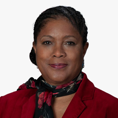
Maria Muse-Duncan
Director
Commercial Capabilities Discovery Office
NGA
Ms. Maria Muse-Duncan, Director, Commercial Capabilities Discovery Office is executing a shared vision of commercial industry and government working together to advance national security. She leads a diverse workforce responsible for coordinating and collaborating on the end-to-end commercial GEOINT process of obtaining NSG users' GEOINT needs, discovering current and emerging capabilities in the commercial market sector, assessing and identifying commercial solutions for mission fitness, and acquiring those that do. In 2022, Ms. Muse-Duncan established the NSG Commercial GEOINT Requirements Process that gathers and prioritizes commercial needs for the community. Ms. Muse-Duncan also served as the Acting Deputy Director of the NGA Commercial Operations Group from February to September 2023. In that leadership role she drove unity of effort across the IC, DoD, and civil organizations to leverage the power of commercial capability to solve mission gaps and enable broader shareability. She previously served as the Deputy Director, Office of Sciences and Methodologies (ATS). She led the day-today operations of the office and assisted the ATS Director in the delivery of innovative applied imagery and geospatial science capabilities in support of national security mission. Ms. Muse-Duncan's portfolio includes assignments as the NGA Lead Integrator to the Allied System Geospatial Intelligence (ASG) for Structured Observation Management (SOM) Integration; the Deputy Director of the National Geospatial-intelligence Agency Support Team (NST) to NSA and USCYBERCOM; the NGA Senior Lead to the National Signals Intelligence Committee (SIGCOM); the Chief of Staff of the Human Geography Joint Program Office, a detail in CIO-T as the Executive Officer to the NGA Chief Information Officer, and more. Ms. Muse-Duncan began her federal career in the United States Air Force (USAF) as a Russian Linguist. She joined NGA in 1999 after working in the private sector, and serving more than 20 years as an active duty and USAF military reservist. She is a retired E-7 Master Sergeant from the USAF Reserves. Ms. Muse-Duncan is a graduate of University of Maryland Global Campus with a B. S. in Business Administration and a M.S. in Management of Information Systems, and is an alumnus of the National Intelligence University. Maria received the Meritorious Civilian Service Award, the DOD Joint Meritorious Award, the 2012 Sharon Parish Leader Award, Deputy Director National Intelligence for Analysis (DDNI/A) Distinguished Analysis Award, and the DOD Joint Meritorious Unit Award in support of 9/11 operations. In 2021, she was selected for promotion to the Defense Intelligence Senior ranks. Ms. Muse-Duncan resides in Anne Arundel County, MD. She is an active member of her church, and has three adult children.

Dr. David Alexander
Senior Science Advisor - Resilience
US DHS

Peter Rabley
CEO
The Open Geospatial Consortium (OGC)

Bert Granberg
Analytics Team Lead
Wasatch Front Regional Council
Plenary Session 4: Government and Governance: Advancing the NSDI for National Development and Sustainability

Moderator
Cyril Smith
State GIO / MassGIS Director
MassGIS (Bureau of Geographic Information)

Garet Couch
President
NTGISC

John Copple
CEO
The Sanborn Map Company
John Copple is the Owner and Chief Executive Officer of The Sanborn Map Company, Inc. (Sanborn). His career spans satellite, aerial, drone, and ground remote sensing technologies. John is a strong believer in the value of remote sensing technologies and geographic information systems and has traveled extensively developing business both domestically and internationally.

Matt Sokol
Chief Data Officer
The Office of the Chief Technology Officer, Government of the District of Columbia

Richard Wade
President
NSGIC

Ryan Bank
Global Managing Director
Geospatial Insurance Consortium [GIC]
Networking Tea/Coffee
Plenary Session 5: Readying the Geospatial Workforce to New Markets, Sources, Technologies, and Practices

Moderator
Robert Sharp
CEO, Global Solutions Former Director
B Sharp - Global Solutions, Former Director NGA
Vice Admiral Bob Sharp, USN (Ret.) served as the Director of the National Geospatial-Intelligence Agency, one of our nation's premier intelligence agencies, from February 2019 until June 2022. As Director, he and his team were responsible for delivering world-class geospatial intelligence to provide a decisive advantage to policy makers, military service members, intelligence professionals, first responders, and international partners. He was accountable for over 14,000 civilian, military and contractor employees working around the clock and globe in over 120 locations world-wide. Bob served as a Naval Intelligence Officer for over 34 years, and as a leader within the Navy's Information Warfare Community since its inception. He has decades of leadership experience in the Intelligence, Defense, and National Security arenas. He is known for his extensive experience developing and motivating cohesive teams to solve complex problems in dynamic situations. He leveraged the global pandemic challenges as an opportunity to reimagine and improve business processes, helping his agency emerge stronger, more agile, and more human from the experience. He holds a Bachelor of Arts from the University of the Pacific and a Master of Science degree in National Resource Strategy from the Industrial College of the Armed Forces. He is currently the CEO of B Sharp - Global Solutions, doing a combination of consulting, advisory and fellowship work focused on helping people who are trying to make the world a better place succeed.

Christopher Frommann
Senior Counselor to the Administrator for Technology
Strategy, and Delivery U.S DHS / FEMA

Ian Warner
Director of Industry Workforce Development & Innovation
Trimble

Dr. Norm Badler
Head of Research
Cesium

Ola Ayeni
Founder & Chief Idea Officer
Claim Academy
Ola Ayeni founded St. Louis-based Claim Academy, which is helping to solve the massive software, cyber and now geospatial developer shortage in the Greater St. Louis area and nationally. Through this coding boot camp, Claim Academy trains people to be industry career ready in just 3.5-months. Claim Academy is one of the 50 Best Coding Bootcamps in the world, according to Courserport and Switchup. Since 2020, Claim Academy has been named one of the best 16 cybersecurity bootcamp in America by Course Report and Fortune Magazine. Graduates of Claim Academy make $72,000 to start even without a college education. Ola is a TedX fellow and a Pulitzer Foundation speaker. When Ola is not working to change lives at Claim Academy and not with his wife Jennifer and their 4 children, he performs several civic duties. He has served on the Downtown Partnership Board, St Louis Promise Zone Workforce Board, Network For Teaching Entrepreneurship, and Design St Louis, nominated by the Mayor. And currently on the Greater St Louis Inc board - A regional initiative with over 3 Million residents. He was the Co-chair MacArthur Foundation Workforce Board and is currently on the board of St Louis Geofutures Coalition and one of the Commissioners of the Botanical Gardens - Zoological District of St Louis.

Seneca Holland
Geospatial Research Scientist & Instructor of Geospatial Science
Conrad Blucher Institute for Surveying and Science
Texas A&M University-Corpus Christi
Cocktail Reception
Gala Dinner
Thursday, September 12, 2024
Deep Dive Sessions
The Integrating Power of Geospatial Across Communities
0800-1030 hrs.Smart and Safe Communities & Citizen Services | Sustainable Energy Future | Transportation Safety

Moderator
Jon Gustafson
Vice President, Americas
Geospatial World LLC
Jon Gustafson has over 20 years of experience in the geospatial and built environment sectors. As Vice President of Americas at Geospatial World, Jon leads efforts to grow and strengthen its position across the Americas. He is dedicated to making a positive impact on the economy and society by promoting geospatial knowledge, advocating for its broad use, and integrating geospatial and space technologies to support sustainability and innovation. His career includes leadership roles at ENR Top 50 companies and the US Army Corps of Engineers, where he spearheaded digital transformation initiatives, managed large multidisciplinary teams, and championed emerging technologies in the AEC industry. Jon is known for his ability to navigate complex market dynamics and develop strategies that align business objectives with sustainable growth. His leadership has fostered innovation, enhanced operational efficiency, and delivered successful, innovation-rich projects across sectors such as transportation, infrastructure, energy, and water resources. With a focus on practical, results-driven solutions, Jon is committed to advancing geospatial knowledge to address global challenges and contribute to the development of smarter, more resilient communities.

Derald Dudley
Chair Geospatial Transportation Subcommittee US Dept of Transportation

Nathan Jones
Assistant Division Chief
Business Administration
Geography Division, U.S. Census Bureau
Nathan Jones is the Assistant Division Chief of Business Administration for the Geography Division, U.S. Census Bureau. He leads the Geography Division's educational efforts, recruitment, contract execution and budget management, and oversight activities. More specifically, Nathan works to ensure the Geography Division has the resources it requires to maintain the MAF/TIGER System, which serves as the basis for all data collection, tabulation, and dissemination at the U.S. Census Bureau. Nathan holds a degree in Geography from The Pennsylvania State University.

John Copple
CEO
The Sanborn Map Company
John Copple is the Owner and Chief Executive Officer of The Sanborn Map Company, Inc. (Sanborn). His career spans satellite, aerial, drone, and ground remote sensing technologies. John is a strong believer in the value of remote sensing technologies and geographic information systems and has traveled extensively developing business both domestically and internationally.

Chris Zarzar, Ph.D.
Director of Weather Strategy and Innovation
TruWeather Solutions
Dr. Chris Zarzar is the Director of Weather Strategy and Innovation at TruWeather Solutions. Chris joined TruWeather Solutions after a career in academia, where he coupled his geospatial and atmospheric sciences background to study the impacts of urban areas on local weather conditions. Through this research, Chris recognized that a lack of low-altitude weather observations was one of the biggest hurdles limiting advancement in local-scale weather predictions. As Director of Weather Strategy and Innovation at TruWeather, Chris builds partnerships and injects cutting-edge science into weather products to deliver state-of-the-art microweather intelligence to support safe, reliable, and resilient autonomous vehicle operations. He holds a Part 107 Certificate, a MA in Geography, and a PhD in Earth and Atmospheric Sciences.

Narendra Babu Vattem
CEO
iSpatial Techno Solutions (IST) Inc.
Mr. Vattem, with over 23 years in the geospatial sector, is a seasoned expert in harnessing transformative technologies to deliver robust enterprise GIS solutions across diverse global landscapes, including the USA, Singapore, the Middle East, and India. His leadership vision is pivotal in sculpting iSpatial's business strategy, enhancing operational effectiveness, and fostering innovation-driven growth. Under his guidance, the company has consistently delivered pioneering GIS, AI, IoT, and Data Analytics solutions for leading global clientele. As a visionary leader, Narendra is instrumental in identifying market potential, forging strategic enterprise alliances, and shaping the future trajectory of solutions and products in the geospatial realm. As the driving force behind iSpatial, he has overseen the successful execution of significant projects in Smart Cities, National Mapping, Spatial Data Infrastructure, Utilities, and Energy. Narendra's forte extends beyond Enterprise Strategy Implementation; he is renowned for fostering an innovation-driven culture, championing new product development, and steering iSpatial towards groundbreaking solutions that address the intricate challenges of today. Armed with an EMBA degree and fortified by PRINCE2 and TOGAF certifications.

Amy Barron
Power Grid Operations Manager
Duke Energy [GIS Carolinas]
Amy attended undergraduate and graduate school at the University of South Carolina. She worked in both public and private sectors before joining Duke Energy in 2008. While at Duke she has used GIS to site substations and transmission lines for the Transmission Engineering Organization and created a common platform GIS application for Real Estate. She was recently the Manager of GIS, Centralized Design, and Residential Development for Customer Delivery Carolinas. Amy co-founded a grassroots GIS Users Group called COMPASS and created and hosts Duke Energy's Annual GIS Day now in its fourteenth year. She is past chair of Energetic Women within Duke and currently sits on the national MEA Energetic Women Leadership Team. She was the first female President of the North Carolina ArcGIS Users Group and currently serves on the NC Geographic Information Coordinating Council, the NC Geodetic Survey Advisory Council, and the NC Underground Damage Prevention Review Board. Amy works out of the Duke Energy Headquarters in Charlotte, NC, and she earned her PLS in 2014 and GISP 2004.

Matt Sokol
Chief Data Officer
The Office of the Chief Technology Officer, Government of the District of Columbia

Daniel Gall
Chief Strategy Officer
US Dept of Veterans Affairs

Amanda Marchetti
Director
Product GTM
Amanda Marchetti is a career geospatial innovation expert with more than 20 years of experience leveraging the latest GEOINT technology for the state, local and federal government communities around the globe.
Amanda comes from key leaders in earth observation technology including Maxar, Nearmap and now BlackSky. As the Director of Product GTM at BlackSky, she shapes the company's impact in market for real time geospatial intelligence to customers in the areas of national security, business intelligence, and community resilience. During her career Amanda has become a subject matter expert and driven industry firsts in spectral imaging capabilities and algorithms that directly connect space-based sensors to real time human impact. Amanda was also a contributor to the Discovery Science series, What on Earth, helping global audiences understand the value of space-based remote sensors.
Amanda and her family make their home in Arvada, CO, where she also volunteers as a leader and teacher in the children's ministry at her local church.
1100-1330 hrs.National Geospatial Infrastructures, A Global Partnership Framework

Moderator
Mark Reichardt
Senior Consultant
Geospatial World LLC

Deirdre Dalpiaz Bishop
Chief Geography Division
U.S. Census Bureau

David Henderson
Chief Geospatial Officer
Ordnance Survey
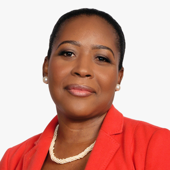
Valrie Grant
Founder and Chairwoman
GeoTechVision
Valrie Grant is an award-winning entrepreneur, Geospatial and Strategy consultant. She is the Founder and Chairwoman of GeoTechVision, a knowledge services company. Valrie is a lifelong learner, who is passionate about Technology and Entrepreneurship and relishes every opportunity to mentor women entrepreneurs and young people.
Valrie Grant is a strategic advisor on geospatial matters to the OECS Commission. One of her initiatives is EduTechAid which seeks to respond to the inequality of access to digital tools in education and empower youths. She has served on several national, regional and international Boards and Committees such as the World Geospatial Industry Council (WGIC) and the United Nations Global Geospatial Information Management (UN-GGIM): Americas Private Sector Network for which she is the current Chair. She is also the vice-chair of UN-GGIM PSN at the global level. Valrie is a 2020 WE Empower UN Sustainability Development Goals Challenge Awardee.
She holds a BSc. in Geology from the University of West Indies and a MSc. in Geographic Information Systems (GIS) and the Environment from the Manchester Metropolitan University, an MBA from Florida Institute of Technology and is currently a doctoral candidate with the University of North Carolina at Charlotte where her research is focused on "Factors influencing the adoption of National Geospatial Information Management (NGIM) in Small Island Developing States (SIDS)".

Melanie Hutchinson
International Lead
UK Geospatial Commission DSIT

Fernando R. Echavarria, Ph.D.
U.S. Department of State
Office of Space Affaris

Eric Loubier
Director General
Natural Resources Canada (NRCan), Canada Centre for Mapping and Earth Observation

Clint Graumann
CEO & Co-Founder
NuView
Clint Graumann is a leading expert in geospatial technology and the CEO & Co-Founder of NUVIEW, where he drives efforts to revolutionize satellite imagery through cutting-edge 3D mapping of the Earth's surface. Under Clint's leadership, NUVIEW is pioneering the world's first commercial space-based LiDAR satellite constellation, which aims to map the entire land surface of the Earth annually in 3D, providing unprecedented access to high-accuracy global data. This technology, capable of overcoming limitations like darkness and dense vegetation, offers seamless data collection under any condition and at any time. With applications across environmental, commercial, and scientific sectors, NUVIEW's continuous global LiDAR mapping is set to address critical global challenges
NUVIEW's leadership in satellite, sensor, and software technologies positions the company as a trailblazer in solving complex global challenges. Clint's extensive experience and deep understanding of the space and geospatial sectors have been key to transforming how satellite imagery is applied. A passionate advocate for global collaboration, Clint works to enhance national and global geospatial infrastructures through strategic partnerships.
NUVIEW has garnered industry recognition, including being named to TIME's Best Inventions of 2023 and receiving the Geospatial World Innovator of the Year award for its revolutionary approach to Earth observation. These accolades highlight Clint's commitment to driving scalable, impactful solutions that push the boundaries of innovation in Earth observation and geospatial data.
Understanding and Responding to Risk
0800-1030 hrs.Community Assessment of NSDI Geospatial Coverages

Moderator
Jill Saligoe-Simmel
Principal Product Manager, Geospatial Infrastructure, SDI & INSPIRE
Esri

Tim Johnson
GIO
State of North Carolina, NC Center for Geographic Information and Analysis

Ken Shaffer
Deputy Executive Director
US Federal Geographic Data Committee
Ken Shaffer is the Deputy Executive Director for the Federal Geographic Data Committee, administered by the U.S. Geological Survey. His work includes the strategic planning and development for the National Spatial Data Infrastructure, Federal geospatial policy, interagency geospatial initiatives, and non-Federal constituent collaboration. Ken's career has been divided between the private, State, and Federal (civil and military) sectors, and has consistently included roles in interagency and multi-tiered geospatial program coordination. A geographer by degree, Ken has 37 years of experience in the geospatial profession.

Bert Granberg
Analytics Team Lead
Wasatch Front Regional Council

Dr. Leslie Jones
GIO
State of Alaska

Megan R. Compton
GIO
State Of Indiana

Richard Wade
President
NSGIC

Garet Couch
President
NTGISC
1100-1330 hrs.Emergency/Disaster Management and Infrastructure | Agriculture, Health and Food Security

Moderator
Ajay Gupta
Co-Founder & CEO, HSR. health,
Board Chair Holy Cross Health
Over a near 30-year career in cybersecurity and IT, Ajay has driven competitive advantage through effective security and technology management. With healthcare's outdated tech and inefficiencies, Ajay founded HSR.health to innovate and improve healthcare delivery. Under his leadership, HSR.health supported COVID-19 response globally and developed a Pandemic Early Warning and Response Platform. Ajay chairs the Health Domain Working Group for the Open Geospatial Consortium, leads Holy Cross Health's Board, and co-chairs the GEO Health Community of Practice. A speaker and published author, Ajay also enjoys sports and singing pop tunes from U2, Sting, George Michael, and Imagine Dragons.

Dawn M.K. Zoldi
CEO & Founder P3 Tech Consulting
Colonel [Retired] USAF
Dawn M.K. Zoldi (Colonel, USAF, Retired) is a licensed attorney with 28 years of combined active duty military and federal civil service to the U.S. Air Force and a Part 107 certified drone pilot. She is the CEO & Founder of P3 Tech Consulting and an internationally recognized expert on uncrewed aircraft system law and policy, featured in CNN, Forbes and Newsweek and on the Public Broadcasting Service television network (show host Emmy-nominated series). Her Dawn of Autonomy podcast (formerly the Dawn of Drones) was recognized as one of the "Top 7 Drone Podcasts 2024 (The Drone Girl) and the "Best Drone Podcast of the Year 2023" (The Droning Company). She has also been recognized by the Great Companies in the consulting category for the 6th International Women Entrepreneur 2024 Awards. Among other accolades, she has been listed as one of the Top Women in Aerospace & Aviation to Follow on LinkedIn for several years. Ms. Zoldi is the author of the book Unmanned Aircraft Systems Legal and Business Considerations: A Modern Primer for U.S. Drone Programs. For more information, follow her on social media and visit her website at: .

Dr. Debra Laefer
Professor, Director Center for Urban Science
and Progress NYU Tandon School of Engineering

Liz Ducey
Account Manager- Public Safety
Esri

John Lesko
Program Manager
Maryland Department of Infomration Technology (DoIT)

Damien Kerr
Geospatial Program Director
Woolpert
Damien Kerr is a seasoned geospatial intelligence professional with over three decades of experience across various leadership roles in both the government and private sectors. Damien recently joined Woolpert as a Program Director for National Security and Intel. Previously, as the Director of GEOINT Innovation at Applied Research Associates, Damien secured substantial Congressional awards and expanded the company's intelligence community portfolio. As a Legislative Affairs Officer at the National Geospatial-Intelligence Agency (NGA), Damien played a critical role in Congressional outreach, contributing to a significant budget increase reflected in the FY20 budget. His leadership as Deputy Director and Acting Director of the Defense Intelligence Agency's (DIA) Underground Facility Analysis Center (UFAC) was recognized with the Defense Intelligence Director's Award in 2018.
Damien holds advanced degrees in National Security and Strategic Studies from the Naval War College and Political Geography from the University of Maryland. His career is marked by numerous awards for excellence in leadership, customer support, and mission dedication, highlighting his commitment to advancing geospatial intelligence and security.

Dr. Rachel Opitz
Program Manager, Geospatial Innovation for Food Security
Taylor Geospatial Institute

Suzy Friedman
Senior Director, Food Policy
World Wildlife Fund
Suzy Friedman is the Senior Director for Food Policy at WWF, where she leads the organization's policy efforts to enable agriculture to be net zero by 2040 and support the economic viability of producers and communities. Specifically, she focuses on policies to advance grasslands conservation and end commodity-driven habitat conversion; scale sustainable protein and feed systems and regenerative agriculture; and eliminate food loss and waste.
Before joining WWF, Suzy served as Vice President for Policy at the National Alliance for Forest Owners. Between 2001 and 2020, she played a lead role in the Environmental Defense Fund's work to build resilience and sustainability of the U.S. agricultural system. To this end, she collaborated with farmers, grower organizations, agribusinesses, food companies and retailers, focusing on outcomes for climate stability, clean water, and farm productivity. Suzy serves on the Board of Directors of Leading Harvest, which provides sustainable agriculture assurance programs.
She holds a bachelor's degree in history and environmental studies from Princeton University and a master's in environmental science and policy from Johns Hopkins University.

Dr. Zenon Medina Cetina
Associate Professor and holder of the Zachry Career Development Professorship II, Zachry Department of Civil & Environmental Engineering
Texas A&M University

Norine W. Bagate
CEO
Mind-i
Transformational Topics
0800-1030 hrs.Advancements in GeoAI Policy, Application, and Implementation

Moderator
Dr. Michael Tischler
Director
National Geospatial Program (NGP)
U.S. Geological Survey (USGS)

Devaki Raj
CDO and AI Officer in Strategy
Saab Inc.

Everett Hinkley
National Remote Sensing Program Manager
US Forest Service

Dr. Samantha T. Arundel
Director
CEGIS, U.S. Geological Survey (USGS)

Travis Hoppe
Assistant Director of AI Research and Development at the White House Office of Science and Technology Policy (OSTP)
EOP Office of Science & Technology Policy

Dr. Eric Shook
Associate Professor
University of Minnesota
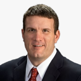
Mark Hogsett
Head of Federal Growth
Rendered AI

Andrew Turner
Director & CTO
R&D Center DC Esri
1100-1330 hrs.Workforce Readiness: Current and Future Generations

Moderator
Sid Pandey
Member
URISA Board of Directors

Christine Devine
Director
Education and Professional Development
United States Geospatial Intelligence Foundation (USGIF)
Christine Devine is the Director of Education and Professional Development at the United States Geospatial Intelligence Foundation (USGIF). She leads the Foundation's educational efforts, including its collegiate accreditation program, K-12 geospatial outreach, scholarship program, and other professional development initiatives. In this role, she works with the GEOINT talent pipeline at every stage to nurture the workforce of tomorrow. Christine is a human geographer by training with degrees in geography from the University of Mary Washington and George Washington University.

Seneca Holland
Geospatial Research Scientist & Instructor of Geospatial Science
Conrad Blucher Institute for Surveying and Science
Texas A&M University-Corpus Christi

Ola Ayeni
Founder & Chief Idea Officer
Claim Academy
Ola Ayeni founded St. Louis-based Claim Academy, which is helping to solve the massive software, cyber and now geospatial developer shortage in the Greater St. Louis area and nationally. Through this coding boot camp, Claim Academy trains people to be industry career ready in just 3.5-months. Claim Academy is one of the 50 Best Coding Bootcamps in the world, according to Courserport and Switchup. Since 2020, Claim Academy has been named one of the best 16 cybersecurity bootcamp in America by Course Report and Fortune Magazine. Graduates of Claim Academy make $72,000 to start even without a college education. Ola is a TedX fellow and a Pulitzer Foundation speaker. When Ola is not working to change lives at Claim Academy and not with his wife Jennifer and their 4 children, he performs several civic duties. He has served on the Downtown Partnership Board, St Louis Promise Zone Workforce Board, Network For Teaching Entrepreneurship, and Design St Louis, nominated by the Mayor. And currently on the Greater St Louis Inc board - A regional initiative with over 3 Million residents. He was the Co-chair MacArthur Foundation Workforce Board and is currently on the board of St Louis Geofutures Coalition and one of the Commissioners of the Botanical Gardens - Zoological District of St Louis.

Talbot Brooks
Director
The Geospatial Center, Delta State University
Professor Talbot Brooks is the Director of the Geospatial Center at Delta State University and program chair for the Bachelor of Applied Science in Geospatial Analysis and Intelligence, a US Geospatial Intelligence Foundation accredited degree program. A 38-year veteran of the fire service, he is Director of the North America Office of the United Nations Platform for Space-Based Disaster and Emergency Response (UN-SPIDER), adjunct faculty at the U.S. National Fire Academy, and Chief Engineer for the Bolivar County Volunteer Fire Department. A retired Army officer, he is passionate about providing educational opportunities for current and former members of the armed services. His entrepreneurial interests include indoor positioning for emergency response (IndoorGeo.com), climate risk and agriculture (ag-management.com). Above all, he is committed to reducing the pain, suffering, and loss caused by crisis through GEOINT education and technologies and expects to complete his doctorate in Fire and Emergency Management at Oklahoma State University in 2025.

Elizabeth O'Keefe Markham
GISP, Deputy Director,
GIS & Technology, Straughan Environmental

Dr. Kathleen Stewart
Professor, Department of Geographical Sciences, Director-Center for Geospatial Informational Science
University of Maryland

Dr. Steve Fleming
Colonel (Retired), U.S. Army
Professor of Geospatial Science and Intelligence
University of North Georgia
COL [R] Steven Fleming (Ph.D.) is a Professor of Geospatial Science and Intelligence with the Institute for Environmental and Spatial Analysis at the University of North Georgia where he teaches courses in geospatial intelligence, military geography, and the spatial sciences. From 2015-2022, he served as a Professor at the University of Southern California's Spatial Sciences Institute and Institute for Creative Technologies. Prior to joining USC, he served on active duty for 30 years in the U.S. Army, fulfilling Joint and NATO duties on multiple deployments in support of Operation Enduring Freedom. He culminated his military career at the United States Military Academy where he was an Academy Professor of Geospatial Information Science. His research specialties focus on applications of geospatial technologies for national defense (military operations, homeland security, and disaster management).
Networking Luncheon
Geospatial Ecosystem Response to the Francis Scott Key Bridge Collapse

Moderator
Mark Reichardt
Senior Consultant
Geospatial World LLC
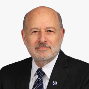
Keynote Speaker
Richard W. Spinrad, Ph.D.
Under Secretary of Commerce
Oceans and Atmosphere & NOAA Administrator

LCDR Ian Hanna
AtoN Operations Section Chief
Coast Guard District Five Waterways Management

Nicole Katsikides
Senior Transportation Specialist
Federal Motor Carrier Safety Administration
U.S. Department of Transportation
Nicole Katsikides is a Senior Transportation Specialist in the Applied Research Division at the Federal Motor Carrier Safety Administration (FMCSA) managing truck parking and research efforts related to truck parking information systems, freight efficiency, and other CMV issues such as sexual assault and harassment in the CMV industry, supply chain and safety impacts, and operational analysis to support the FSK bridge collapse. She is especially known for truck parking and supply chain fluidity research.
Nicole has held several different positions in the industry including Maryland's Director Freight and Multimodal Transportation, Deputy Director of Maryland State Highway Office of Planning and Preliminary Engineering, FHWA's Freight Performance Program Manager, and Researcher at the Texas A&M Transportation Institute. Nicole has a Ph.D. in Public Policy from the University of Maryland Baltimore County, a master's in policy studies from Johns Hopkins, and B.A. from the University of Notre Dame of Maryland. She is currently working on a certificate in Geospatial Information Systems at the Texas A&M University. Further, Nicole teaches freight logistics for the Community College of Baltimore County.

George Ohanian
Director Warfighter Support
US Army Geospatial Center, US Army Corps of Engineers

Dawn Blanchard
GIS Program Manager
Department of Information Technology (DoIT), State of Maryland